
Sèrie: ETSAB. Lectures de Tesis Doctorals (2014-2025)
8 de maig 2014

A New Strategy of ICT Integrated Methodologies for 3D Documentation.
Accés obert
8 de maig 2014
Presentació de la Tesi Doctoral a la Sala de Juntes ETSAB. Director de Tesi: Ernest Redondo Domínguez (Departament d'Expressió Gràfica Arquitectònica I,ETSAB UPC). Codirector de Tesi: Adnan A. Adas (Department of Architecture, (CED, King Abdullah University, Arabia Saudi). Membres del Tribunal: President: Pau de Solà Morales Serra (Unitat Predepartamental d'Arquitectura, Escola Tècnica Superior d'Arquitectura , Universitat Rovira i Virgili). Secretari: Joaquim Regot Marimón (Departament d'Expressió Gràfica Arquitectònica I, ETSAB UPC). Vocal: Fabrizio Agnello (Dipartimento di Architettura, Facoltá di Architettura, Laboratoio di Computer Grafica, Università degli Studi di Palermo, Italia).
The Roshan represents one of the most characteristic aspects of traditional architecture in Hejaz region in Saudi Arabia and a frequent feature in most of the Historical Jeddah’s heritage buildings. The old city has witnessed continued degradation recently, which has caused the loss its traditional architecture and hundreds of these projected wooden windows. Documentation is a major step towards heritage preservation, whether threatened by man-made or natural factors. However, due to the absence of specialists and experts an architectural database of the roshans does not exist. Surveying these architectural elements is a very laborious and difficult process when using conventional methodologies including the laser sensors approach mainly due to the onsite limitations. Establishing an architectural database of the roshans is the main objective in this investigation. Thus, this research presents a new of ICT integrated methodologies based on the continuous development of data capture and modelling methodologies that allows the accurate recording the most complex parts even intricate details and ornaments which are typically found in roshans. Recent advances in image based techniques (digital close-range photogrammetry and computer vision) such as the semi-automated and automated solutions of Dense Stereo Matching (DSM), Structure from Motion (SfM) and 3D modelling software has offered an accurate, inexpensive and practical solution to surveying, documenting and reconstructing these architectural heritage features. In this research the application of these methods is tested and evaluated on the roshans in the historical city of Jeddah.
In addition, there is an immediate need for training new technicians and architects who could ensure documentation and conservation of remaining heritage. Thus, we propose an integration of new technologies, flexible, high interconnectivity, and high usability data formats to capture, model, and simulate these elements of heritage interest. For this purpose, an academic experiment involving architecture students from Jeddah was designed. The experiment required students to engage with a new integration of ICT-Hybrid technologies that incorporate dynamic and fast processes for 3D documentation and modelling. In this research, we evaluate the usability of the proposed strategy as well as investigate ideas that may bring us closer to the goal of effective heritage documentation.
9 de març 2018
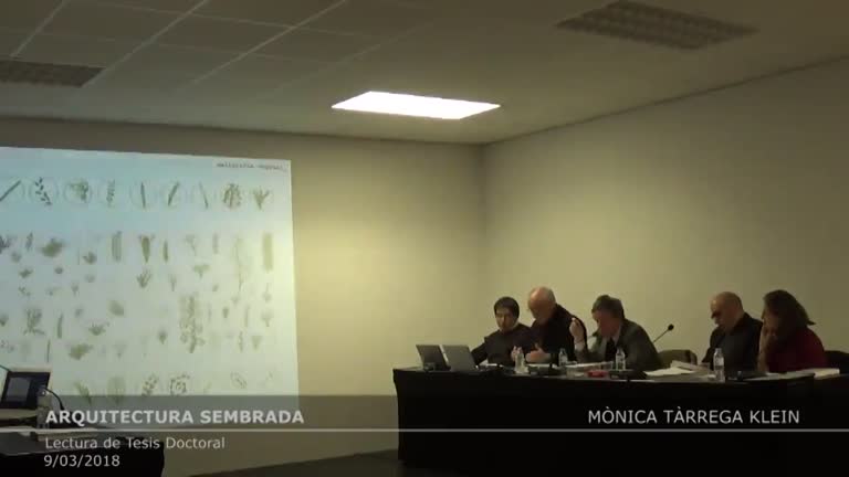
Arquitectura sembrada. Atlas de encuentros entre vegetación y arquitectura
Accés obert
9 de març 2018
Lectura de Tesis Doctoral a càrrec de Mònica Tàrrega Klein. Directora de Tesi: Cristina Jover (Departament de Projectes Arquitectònics ETSAB).
26 de nov. 2015
Cartografia operativa. Usos del Mapa al Projecte Arquitectònic, 1982-2012
Accés obert
26 de nov. 2015
Tesi Doctoral de Roger Paez i Blanch. Director: Iñaki Ábalos (ETSAM-UPM / Harvard GSD). Co-director: Jaime Coll (ETSAB-UPC). Departament de Projectes Arquitectònics. Escola Tècnica Superior d'Arquitectura de Barcelona, Universitat Politècnica de Catalunya.
Tesi Doctoral dipositada a TDX: http://www.tdx.cat/handle/10803/327026
We live in a complex world. For some time, the great certainties and the narratives they support have been shown to be inadequate as an entryway into the richness of the contemporary world. lt is not just a question of understanding the world around us, but also of developing the conceptual frameworks and the tools to help us transform it. Spatial design practices, with architecture at the head, play a fundamental role in this question, because they are active agents in both interpreting and shaping the reality we live in. Based on that interest, this dissertation explores the critical uses of maps in architectural design, and it posits the concept of operative cartography as the backbone to structure the work. In its most immediate definition, operative cartography is the production and use of maps to broaden our conception of reality and to promote its transformation. The concept is founded on understanding maps as design tools: they don't just inform; they primarily propose. Maps construct reality in a particular way. As such, cartography is a propositional discipline, not a merely descriptive one. The potentially operative nature of maps in architectural design is clear. The specific constructions of reality inherent in maps not only open up new conceptions of the reality being mapped; they also present new possibilities for a real transformation of the milieu. In this sense, mapping and maps are put forward as tools with an enormous power to affect the design processes that are used to transform our environment. This dissertation studies the difieren!t kinds of operative relationships between maps and architectural design, and it outlines avenues for an in-depth exploration of this relationship. The first part is the most speculative: it introduces and develops the concept of operative cartography as an agent with the ability to expand on the objectives , methods and tooIs of contemporary architectural design. The second, more expository part shows that the map is a rich and complex document, which has been claimed culturally from contrasting positions . Part three, evocative in tone, makes it clear that maps are an endless source of interpretative richness that reach far beyond the dominant, scientific and positivist, vision of cartography. Finally, part four is the most demonstrative. First, it proposes a taxonomy of the areas and modes of cartographic operativity in architectural design during the period 1982-2012; then the validity and utility of that taxonomy is tested through the study of 24 recent designs. The case studies begin with a projective survey of the conditions of the milieu subject to intervention. From difierent architectural sensitivities, they all work pragmatically and critically, acknowledging the need for an effective transformation of the milieu based on an understanding of pre-existing conditions, without being subject, however, to the tyranny of what already is . Based on the concept and practices of operative cartography, we can build bridges to create a dialog between what exists and what doesn't exist yet: in other words, design. This encourages an active and innovative architecture based on the effective and symbolic expansion of the milieu. The main aim of this dissertation is to offer a methodological contribution to architectural design, both in conceptual and instrumental terms. The dissertation takes a pragmatist angle, which aims not only to discuss the present but, above all, to generate a toolbox to help expand on the objectives, methodologies and formats of architectural design in the immediate future.
Vivim en un món complex. Ja fa temps que les grans certeses i les narracions que aquestes suporten s'han demostrat inadequades per accedir a la riquesa del món contemporani. No es tracta només de saber entendre el nostre entorn sinó, en igual mesura, de desenvolupar els marcs conceptuals i les eines que ens permetin transformar-lo. Les disciplines del projecte espacial, amb l'arquitectura al capdavant, juguen un paper fonamental en aquesta qüestió, ja que són agents actius tant en la interpretació com en la configuració de la realitat en la qual vivim. Partint d'aquest interès, la tesi doctoral explora els usos crítics de la cartografia en l'àmbit del projecte arquitectònic, i proposa el concepte de cartografia operativa com a espina dorsal per ordenar el treball. En la seva definició més inmediata possible, la cartografia operativa és la producció i utilització de mapes per ampliar la nostra concepció de la realitat i promoure'n la transformació. Aquest concepte parteix d'entendre la cartografia com una eina projectiva: els mapes no només informen sinó que sobretot proposen. La cartografia construeix la realitat de manera concreta i és, per tant, una disciplina propositiva i no pas simplement descriptiva. El caràcter potencialment operatiu de la cartografia en el marc del projecte arquitectònic és clar. A partir de les construccions concretes de la realitat efectuades pel mapa, s'obren no només noves concepcions de la realitat cartografiada sinó també noves possibilitats per a transformar-la. Així doncs, la pràctica cartogràfica i el mapa com a document són eines amb un enorme poder per afectar els processos de projecte a través dels quals es transforma l'entorn dels homes. La tesi estudia les diferents maneres a través de les quals s'estableixen relacions operatives entre la cartografía i el projecte arquitectònic, i delinea camins per explorar en profunditat aquesta relació. La primera part és la més especulativa: proposa i desenvolupa el concepte de cartografia operativa com un agent amb capacitat d'ampliar els objectius, mètodes i eines del projecte arquitectònic contemporani. La segona part, de caràcter expositiu, mostra que el mapa és un document ric i complex que ha estat incardinat culturalment des de posicions molt diferenciades. La tercera part, de to evocatiu, palesa que els mapes són una font inesgotable de riquesa interpretativa que van molt més enllà del que pretén la visió dominant de la cartografia, d'arrel científica i positivista. La quarta i última part és la més demostrativa. En primer lloc proposa una taxonomia dels modes d'operativitat cartogràfica en el projecte arquitectònic en el període 1982-2012, i després comprova la seva validesa i utilitat a través de l'estudi de vint-i-quatre projectes recents. Els projectes estudiats parteixen d'un reconeixement projectiu de les condicions de l'entorn on es treballa. Des de sensibilitats arquitectòniques molt diverses, tots ells treballen simultàniament des del pragmatisme i la crítica, assumint la necessitat d'intervenir efectivament en la transformació de l'entorn a partir d'una comprensió d'allò existent, sense per això estar sotmès a la tirania del que (ja) és. A través del concepte i les pràctiques de cartografia operativa es poden construir ponts de diàleg entre allò existent i allò que encara no existeix, és a dir, el projecte. D'aquesta manera es fomenta una arquitectura inquieta i innovadora basada en l'ampliació tan efectiva com simbòlica de l'entorn. L'objectiu principal d'aquesta tesi és aportar una contribució metodològica, tant conceptual com instrumental, als projectes arquitectònics. La tesi adopta una angulació pragmatista, que busca no només explicar el present sinó sobretot generar una caixa d'eines que permeti ampliar els objectius, les metodologies i els formats del projecte arquitectònic en el futur immediat. [-]
1 de gen. 2013
Proyectos del Realismo crítico en la era de la simultaneidad: debates sobre la gestión de la información y las actuaciones en la ciudad construida
Accés obert
1 de gen. 2013
Presentació de Tesi Doctoral de Ferran Grau Valldosera. Director: Josep Lluís Mateo (Swiss Federal institute of Technology in Zurich (ETHZ). Co-director: Eduard Bru (PA-ETSAB). Departament de Projectes Arquitectònics. Escola Tècnica Superior d'Arquitectura de Barcelona, Universitat Politècnica de Catalunya. Tesi Doctoral dipositada a TDX:http://hdl.handle.net/10803/134688
Realism in architecture is a "mutant' concept which admits multiple meanings. Accordingly it would be more precise to talk about realism - in plural - and to try to properly place each one in the contemporary context. at the same time, the relation between realism and architecture is not precise and specific anymore, we could even say it is not "real" any longer and, paradoxically, it has become more abstract. This new situation has a reason: the multiplicity of meanings that architectural realism has assumed. Trends which use architecture adjectivally are increasing more and more. For example, we can talk about high tech, iconic, virtual, sustainable, modern, commercial, classic-postmodern, or real architecture, among others. Facing this architectural variety, the debate between "realist" and "non realist" is increasingly becoming a complex issue. ln the architectural context, the main difficulty in order ta comprehend realism and specifically critic realism is precisely the definition of the meaning of "realism". We usually refer to realism in terms of what has meant in the past and not what it means in the present. The recognition of architecture realism's mutability and therefore the multiplicity of meanings establish a starting point tor this research. Among all realisms, there is one which assumes a critical attitude and a commitment with the built city as well as with the complexity of the new information Age and of globalization. In turn, architectural critical realism also assumes different forms which place it in the frame of resistance to the global; cammunicative and urban integration will; social and environmental commitment; technological development and programmatic pragmatism. This research approaches the (fragmented) definition of architectural critical realism through the study of projects built in Western Europe since 1980s and supported with references from postwar reaism (1950-1960) and the artistic and literary realism of the second half of the 191th century. Architecture of critic realism claims to be an "ethic attitude" as new brutalism was in the postwar and also in the 19th century. This attitude settles ils architectural proposals in the knowledge of reality understood as a physical, social, political, economical, technological and cultural context. It recognizes the complexity of globalization and of the new information age. At the same time it assumes a strong commitment with the built city, society and archilectural discipline. The age of simultaneity-which chronologically contextualizes this research - is a consequence of the technological and informative revolution consolidated since the 1990s at the same time as the global transfer from analogical to digital was taking place. In the architectural environment we can recognize simultaneity in hybrid programs, the new professinal partenship (increasing collaboration with consultants) and the new construction management systems (for example the fast track). One of the consequences of simultaneity is the difficulty in information management. ln this aspect, critic realism always tries to work with the essential information required for an architectural design. The built city is the natural scenario for the critic and realist attitude; a city which is the result of globalization effects such as urbanalization of historic centers and outs kirts, and the inevitable absorption of the periphery -which was one of the big issues of the 1980s. Critic realism intervenes in this context aiming to revitalize, transofrm, restore and even demolish it if necessary. In any case critic realism always acts with the aim to build or rebuild the identity of the built city and to set up the idea of urban sense of belonging.
Realism in architecture is a "mutant' concept which admits multiple meanings. Accordingly it would be more precise to talk about realism - in plural - and to try to properly place each one in the contemporary context. at the same time, the relation between realism and architecture is not precise and specific anymore, we could even say it is not "real" any longer and, paradoxically, it has become more abstract. This new situation has a reason: the multiplicity of meanings that architectural realism has assumed. Trends which use architecture adjectivally are increasing more and more. For example, we can talk about high tech, iconic, virtual, sustainable, modern, commercial, classic-postmodern, or real architecture, among others. Facing this architectural variety, the debate between "realist" and "non realist" is increasingly becoming a complex issue. ln the architectural context, the main difficulty in order ta comprehend realism and specifically critic realism is precisely the definition of the meaning of "realism". We usually refer to realism in terms of what has meant in the past and not what it means in the present. The recognition of architecture realism's mutability and therefore the multiplicity of meanings establish a starting point tor this research. Among all realisms, there is one which assumes a critical attitude and a commitment with the built city as well as with the complexity of the new information Age and of globalization. In turn, architectural critical realism also assumes different forms which place it in the frame of resistance to the global; cammunicative and urban integration will; social and environmental commitment; technological development and programmatic pragmatism. This research approaches the (fragmented) definition of architectural critical realism through the study of projects built in Western Europe since 1980s and supported with references from postwar reaism (1950-1960) and the artistic and literary realism of the second half of the 191th century. Architecture of critic realism claims to be an "ethic attitude" as new brutalism was in the postwar and also in the 19th century. This attitude settles ils architectural proposals in the knowledge of reality understood as a physical, social, political, economical, technological and cultural context. It recognizes the complexity of globalization and of the new information age. At the same time it assumes a strong commitment with the built city, society and archilectural discipline. The age of simultaneity-which chronologically contextualizes this research - is a consequence of the technological and informative revolution consolidated since the 1990s at the same time as the global transfer from analogical to digital was taking place. In the architectural environment we can recognize simultaneity in hybrid programs, the new professinal partenship (increasing collaboration with consultants) and the new construction management systems (for example the fast track). One of the consequences of simultaneity is the difficulty in information management. ln this aspect, critic realism always tries to work with the essential information required for an architectural design. The built city is the natural scenario for the critic and realist attitude; a city which is the result of globalization effects such as urbanalization of historic centers and outs kirts, and the inevitable absorption of the periphery -which was one of the big issues of the 1980s. Critic realism intervenes in this context aiming to revitalize, transofrm, restore and even demolish it if necessary. In any case critic realism always acts with the aim to build or rebuild the identity of the built city and to set up the idea of urban sense of belonging.
12 de gen. 2018
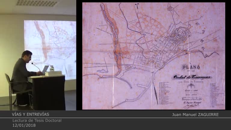
Vías y entrevías. Atributos y compromisos del distrito industrial de Tarragona
Accés obert
12 de gen. 2018
Lectura de Tesi Doctoral a càrrec de Juan Manuel Zaguirre. Dr. Josep Parcerisa Bundó, Director. Tribunal: Dr. José Luis Gómez Ordóñez / UGranada. Dr. Carles Crosas Armengol / UPC. Dr. Jordi Sardá Ferran / URV. Dr. Pau de Solá-Morales Serra / URV. Dr. Miquel Martí Casanovas / UPC. Dr. Xabier Eizaguirre Garaitagoitia / UPC. Dr. Juan Luis Rivas Navarro / UGranada.
- ← Anterior
- 1 (current)
- Següent →
